
Travel
Where’s Kona? Unveiling the Heart of Hawaii’s Big Island

Published
4 months agoon

Table of Contents
ToggleIntroduction
Imagine a place where the sun kisses the ocean with a golden glow, where the scent of freshly roasted coffee mingles with the salt spray of the Pacific, and where ancient Hawaiian history is etched into the very landscape. This is Kona, a name that conjures images of paradise, but also one that often leads to geographical confusion. If you’ve ever found yourself asking, “Where’s Kona?” you are not alone. The answer is more nuanced than you might think. Often used interchangeably with the name of a town, Kona is actually a district that encompasses the entire western coast of the Island of Hawaii. At its heart lies the vibrant seaside town of Kailua-Kona, the bustling hub of this storied region . This article serves as your definitive guide to understanding where Kona is, why it is so special, and how to plan the perfect trip to this extraordinary corner of the Hawaiian Islands.
Decoding Kona: More Than Just a Name
To understand “where’s Kona,” you must first understand that the name refers to two different, yet related, things. Kona is a district on the western side of the Big Island of Hawaii, often referred to as the “Kona Coast” or the “leeward” side . The term “kona” itself translates to “leeward” or “dry” in Hawaiian, which accurately describes the region’s famously sunny and arid climate . The largest town in this district is Kailua-Kona . The name is a combination of its original Hawaiian name, Kailua, and the district, Kona, to distinguish it from other towns named Kailua on the islands of Oahu and Maui . So, when someone asks “Where is Kailua-Kona?” the answer is: it is the main coastal town on the Kona district of Hawaii Island. When most people say they are “going to Kona,” they are usually referring to this vibrant town and its immediate surroundings, which serve as the epicenter of activity on the island’s west coast .
A Deep Dive into Kona’s Geography and Significance
Geographically, Kailua-Kona is situated on the west-central coast of the Island of Hawaii, resting along Kailua Bay at the foot of the dormant Hualalai Volcano . Its location on the leeward side of the island is crucial to its identity. Unlike the lush, rainy, and often cloudy eastern side of the island (home to the city of Hilo), the Kona coast is characterized by its dry, sunny weather, making it a haven for beachgoers and outdoor enthusiasts . This geographical distinction is not just about weather; it has shaped the region’s history and culture. For centuries, the calm, sunny conditions of Kona made it a highly desirable place to live. It was the residence of the great Hawaiian king, Kamehameha I, who made Kailua his capital in the early 19th century after uniting the islands . The town was also the site of early contact with Europeans, most notably the landing of Captain James Cook, and the first missionary efforts in Hawaii . Today, this rich history is preserved in landmarks like the Hulihee Palace, a museum that was once a summer home for Hawaiian royalty, and the Moku’aikaua Church, the first Christian church built in Hawaii, which still stands as a testament to the area’s layered past .
Kona Coffee and World-Class Adventures
The Kona district is world-famous for its coffee, a premium bean grown on the fertile volcanic slopes of Hualalai and Mauna Loa . The unique microclimate—a mix of warm, sunny mornings and cool, rainy afternoons—creates the perfect conditions for the prized Kona coffee cherries. Visiting a coffee farm, like the Kona Coffee Living History Farm, offers a fascinating glimpse into the region’s agricultural heritage and provides a taste of this world-renowned brew . Beyond the coffee farms, Kailua-Kona is the primary launchpad for a vast array of Big Island adventures. From its piers and harbors, visitors can embark on deep-sea fishing charters, renowned for their Pacific blue marlin, or join a magical nighttime snorkel tour to swim with graceful manta rays . The town’s strategic position also makes it the ideal base for exploring further afield. Travelers can drive to the summit of Mauna Kea to witness some of the world’s most spectacular stargazing, or take a day trip to the Hawaii Volcanoes National Park to see the awe-inspiring power of Kilauea, one of the world’s most active volcanoes .
Best Times to Visit and Essential Travel Tips
Kona enjoys balmy beach weather year-round, with temperatures typically ranging from 69°F to 86°F . However, the best time to visit depends on your priorities. For a combination of warm, dry weather and fewer crowds, the shoulder seasons of spring (April to May) and fall (September to October) are excellent choices . If your goal is to witness migrating humpback whales, plan your trip for the winter months (December to March), though this is also the peak tourist season with higher prices and bigger crowds . Summer (June to August) offers perfect, sunny days for beach and water activities, but also brings the highest volume of tourists . When planning your trip, it’s important to note that Kona is a driving destination. While downtown Kailua-Kona is walkable, having a rental car is almost essential to explore the far-flung beaches, coffee farms, and natural wonders that make the island so special . With its rich history, perfect weather, and endless activities, Kona is not just a place on a map; it is a destination that delivers a quintessential Hawaiian experience.
Conclusion
In conclusion, the question “Where’s Kona?” reveals a gateway to the very best of Hawaii’s Big Island. It is a destination that defies simple definition, existing as both a sprawling, historically significant district and a bustling, modern seaside town. Kailua-Kona serves as the perfect introduction to the island’s unique spirit, offering a blend of world-class adventures, from snorkeling with manta rays to exploring volcanic landscapes. Its history is palpable, having served as the seat of Hawaiian royalty and a landing site for European explorers, while its present is vibrant, fueled by the world’s most famous coffee and the spirit of aloha. Whether you are seeking a relaxing beach vacation, a culturally enriching journey, or a high-adventure expedition, Kona is the starting point. It is a place that not only answers the question of location but also invites you to discover the heart and soul of Hawaii Island itself.
Frequently Asked Questions (FAQs)
1. Where exactly is Kona, Hawaii?
Kona is a district on the west coast of the Island of Hawaii, which is the largest island in the Hawaiian archipelago. The main town in this district is Kailua-Kona, located on the west-central coast of the island .
2. Is Kona on the same island as Honolulu?
No. Honolulu is on the island of Oahu, while Kona (specifically Kailua-Kona) is on the Island of Hawaii (often called the “Big Island”). The two islands are about a 45-minute flight apart .
3. What is the best time of year to visit Kona?
The best times are during the shoulder seasons of spring (April to May) and fall (September to October) for good weather and fewer crowds. For warm, dry weather, summer is excellent but busy. Winter is the rainy season but offers the best whale-watching opportunities .
4. What is Kona most famous for?
Kona is world-renowned for its premium Kona coffee and its excellent fishing and snorkeling, especially the unique nighttime manta ray snorkel. It’s also famous for hosting the annual Ironman World Championship triathlon .
5. Do I need a rental car in Kona?
Yes, having a rental car is highly recommended. While Kailua-Kona town is walkable, exploring the district’s famous coffee farms, beaches, and popular attractions like Volcanoes National Park requires a car .
You may like
Travel
The Ultimate Guide to Finding the Best “Motel Cerca de Mi”: Your Roadmap to Local SEO and the Perfect Stay
Published
3 months agoon
July 29, 2026
Table of Contents
ToggleIn the fast-paced world of travel, few searches are as urgent and location-specific as “motel cerca de mi” or “motel near me.” Whether you are a weary traveler embarking on a cross-country road trip, a budget-conscious tourist looking to save on accommodation costs, or simply someone in need of a quick and comfortable place to rest for the night, this search query represents a moment of high intent. The traveler is ready to book, and the only question is which establishment will earn their business. For business owners, mastering the art of being found for this specific search is the holy grail of local digital marketing. On the consumer side, knowing how to decipher the results ensures you get the best value and convenience for your specific situation. This comprehensive article will serve as a dual-purpose guide: first, it will explain the intricacies of local SEO for motels targeting the “cerca de mi” searcher, and second, it will provide travelers with an insider’s view on what to expect from a motel versus a hotel, ensuring you make the right choice every time you type those keywords into your search bar.
Part 1: The Art of Local SEO for “Motel Cerca de Mi”
Understanding the local search landscape is critical for any motel owner who wants to survive and thrive. When a traveler types “motel cerca de mi” into Google or Bing, they are often looking for immediate gratification; they want to see what is available in their immediate vicinity at that exact moment. This type of query triggers Google’s local search algorithm, which prioritizes relevance, distance, and prominence.
Optimizing Your Google Business Profile
The single most important tool for ranking in “near me” searches is your Google Business Profile (GBP). For a motel, this profile is your digital storefront, and it must be meticulously maintained. If you want to appear in the coveted “Local Pack” (the top three results displayed on a map), your GBP must contain high-quality, recent photos of your property, accurate operational hours, and a detailed description packed with relevant keywords.
One of the key elements of SEO in the hospitality industry is identifying the long-tail keywords that your ideal guest is actually searching for. Instead of just “motel,” think about what makes your property unique. Are you a “dog-friendly motel in [city name]”? Are you located near a specific highway exit, which is a major advantage for a motel? Are you a “budget motel near the airport”? These specific phrases are less competitive but have a higher conversion rate because they match the exact intent of the user. Integrating these keywords naturally into your Google Business Profile description and your website copy signals to search engines exactly who should see your listing. Additionally, fresh activity on your profile is crucial. Encouraging real reviews from guests and responding to them, posting weekly updates about local attractions or specials, and adding new photos all signal to Google that your business is active and relevant, which gives you a competitive edge over properties that have been abandoned online.
Website Optimization and Content Strategy
Having a website that functions more than just a brochure is essential for converting a search into a booking. Google prioritizes mobile-friendly and fast-loading sites, and since most “near me” searches occur on a smartphone, a seamless mobile booking process is non-negotiable. Beyond performance, the structure of your site matters immensely. To capture a wider range of traffic, consider creating hyper-optimized pages for specific local intents. For example, a page dedicated to “Motels near [Local Landmark]” or “Rooms for [Local Event]” targets long-tail traffic that is often ignored by national chains. If you want to delve deeper into the geographical strategy, consider the value of local keywords like “Motel in [City Name]” or “Motel cerca de [Main Highway]”.
Part 2: Understanding the Motel Identity and Service Experience
For the traveler, understanding what the term “motel” means today is key to having a satisfying experience. The name itself is a portmanteau of “motor” and “hotel,” originating in the United States in the 1920s. These establishments were built specifically for the automobile traveler, offering quick and direct access to rooms. While the lines between motels and hotels are blurring in the modern era, specific structural and service differences remain. A motel is typically defined by its exterior-corridor design, where guests park directly in front of their room and enter from the outside parking lot. This architectural feature is the motel’s defining characteristic and provides immediate convenience. A traveler can unload luggage directly from the car to the room without navigating through a lobby, elevators, and long interior hallways. This is an incredible time-saver for road-trippers carrying heavy bags or families with small children.
Differences Between Motels and Hotels
To paint a clear picture of the trade-offs between a motel and a hotel, we must look at price, amenities, and atmosphere. Hotels are generally multi-story buildings located in urban centers or tourist destinations, designed for leisure or luxury. They provide a wide array of services, including room service, doormen, concierge services, and often multiple in-house dining options. The higher level of service and amenities inevitably drives up the price. In contrast, motels are generally located along the roadside or near highway interchanges, reflecting their purpose as a functional pit stop for travelers on the move. This focus on efficiency allows motels to maintain a significantly lower price point than hotels.
The difference in experience is equally important. A hotel stay is often considered an experience in itself, where the property is the destination. A motel, however, offers a “no-frills” or “bare-bones” experience where the emphasis is on the bed and the bathroom. While a hotel might have a fitness center, a swimming pool, a business center, and a spa, a motel might offer vending machines, a modest continental breakfast with coffee and pastries, and free parking right outside the door. Services are minimal, often self-service, and there is less interaction with staff unless required. For budget travelers or those who plan to spend the entire day exploring, this stripped-back approach is a highly efficient way to save money without sacrificing a good night’s sleep. A recent breakdown of different accommodations confirms this spectrum, placing motels at the convenient, cost-effective end of the spectrum versus resorts and luxury hotels at the destination-focused end.
Quick Comparison Table
| Feature | Motel | Hotel |
|---|---|---|
| Primary Purpose | Convenient pit stop for road travelers | Destination stay or base for exploration |
| Location | Highways, interstates, suburbs | City centers, tourist districts, airports |
| Architecture | Low-rise, exterior corridors, parking at the door | High-rise, interior corridors, separate parking structure |
| Price Range | Budget-friendly, generally lower cost | Wide range, generally more expensive |
| Services & Amenities | Basic (coffee, vending machines, pool) | Extensive (gym, restaurants, room service, concierge) |
Conclusion
Whether you are an entrepreneur looking to optimize your digital presence or a traveler planning your next adventure, the phrase “motel cerca de mi” represents an intersection of convenience, budget, and technology. For businesses, the path to success lies in the integration of solid local SEO tactics, from optimizing your Google Business Profile with specific keywords to building a user-friendly, content-rich website that speaks directly to the needs of the weary driver. Understanding the difference between a hotel and a motel is not just about semantics; it is about matching your budget, comfort, and convenience needs with the right type of accommodation. For travelers, knowing that motels prioritize efficiency and accessibility over luxury can ensure your expectations are met and perhaps exceeded. By understanding the mechanics behind the search, both business owners and travelers can navigate the road ahead with confidence.
Frequently Asked Questions (FAQ)
Q1: What does “motel cerca de mi” mean in English?
A: It translates to “motel near me.” This is a local search query used to find motels located in close proximity to the user’s current location. Search engines use GPS data to provide the most relevant results for this query.
Q2: What is the main difference between a motel and a hotel?
A: The main differences are structural and functional. A motel typically has exterior corridors where rooms open onto the parking lot, offering immediate access to your vehicle, and is designed for quick, budget-friendly stops. A hotel usually has interior corridors accessible via a lobby and elevators, and tends to offer more amenities and services. Another way to think about it is that a motel is for the journey, while a hotel often serves as the destination.
Q3: Why is local SEO important for a motel?
A: Local SEO is crucial because most people searching for accommodations are looking within a specific geographic area. By optimizing local search presence, a motel ensures it appears in search results for potential guests nearby, directly influencing foot traffic and bookings.
Q4: Are motels cheaper than hotels?
A: Generally, yes. Motels are usually more budget-friendly because they focus on basic amenities and function, whereas hotels provide a wider range of services and amenities that often come at a higher cost. This price difference makes motels a popular choice for cost-conscious travelers on long road trips.
Q5: How can I find a reliable motel when searching “near me”?
A: To find a reliable motel, check the reviews on your search engine or booking platform. Look for motels with high ratings and recent, positive feedback. This will give you insight into the cleanliness, safety, and service quality of the property before you book.
Travel
Travelocity Car Rental: The Ultimate Guide to Booking, Saving, and Navigating the Road Ahead
Published
3 months agoon
July 29, 2026
Table of Contents
TogglePlanning a trip involves countless decisions, and securing reliable transportation is often at the top of the list. For many travelers, the search for a rental car leads to major online travel agencies like Travelocity, drawn by the promise of competitive deals and a streamlined booking process. This comprehensive guide delves into everything you need to know about using Travelocity for car rentals. We will explore the platform’s booking process, its advantages and hidden pitfalls, proven strategies for securing the best rates, and insights from real customer experiences to help you make an informed decision for your next journey.
Decoding the Travelocity Car Rental Platform
When you visit Travelocity to book a car, you are not dealing directly with a rental company like Hertz or Avis. Instead, Travelocity functions as a powerful aggregator and third-party booking agent . This means they compare prices, vehicle availability, and rental terms from numerous suppliers, displaying them in a user-friendly interface so you can find the best option for your needs . The primary advantage of this model is convenience. You can quickly compare a wide range of vehicles—from budget-friendly economy cars to premium SUVs and luxury models—all without visiting multiple websites .
The platform is designed to simplify the process. The user journey typically begins on the Travelocity homepage, where you input your destination, pick-up date and time, and return details. Using filters, you can refine results based on vehicle type, price range, and specific features such as all-wheel drive or capacity for larger groups . Travelocity partners with a vast network of well-known providers, including Avis, Budget, Enterprise, Alamo, and Europcar, giving customers plenty of choices . From a strategic standpoint, Travelocity’s strength lies in its ability to offer a vast selection and price transparency, making it a popular starting point for travelers looking to compare options .
The Duality of Customer Experience: A Reality Check
Understanding the full picture requires looking beyond the glossy marketing. The reality of booking a car rental through Travelocity reveals a stark duality in customer experiences, characterized by both satisfaction and significant frustration.
The Success Stories: What Works Well
The positive feedback for Travelocity car rentals typically highlights two key aspects: ease of booking and the power of comparison. For long-time users and those whose trips proceed without a hitch, the platform is a reliable tool. The ability to quickly compare a multitude of offers and select a vehicle that meets both budget and practical needs is a significant benefit . The platform successfully aggregates options and provides a clear overview, allowing customers to book with confidence when everything aligns . When issues do arise with airlines or hotels, some customers have reported that Travelocity’s customer service team was effective in resolving problems, particularly compared to dealing directly with unresponsive airlines . In these scenarios, Travelocity acted as a helpful intermediary.
The Horror Stories: Key Warning Signs
However, a substantial number of complaints paint a more troubling picture, with several recurring themes that can turn a trip into a nightmare.
1. The “Bait and Switch” at the Rental Counter
One of the most prevalent and anger-inducing experiences involves unexpected charges and aggressive upselling at the rental counter. Customers have reported booking a car at a certain price online, only to be hit with mandatory add-ons upon arrival. For instance, one customer booked a vehicle for $665 through Travelocity with an off-airport company at Hollywood International Airport. Upon pickup, the counter representative insisted on adding a toll pass at $18 per day and extra insurance at $40 per day, effectively more than doubling the expected cost. The customer felt pressured into accepting or forced to cancel on the spot, losing their initial payment . Another traveler booked a car in the UK, paying £495 in advance for an 18-day rental. When their flight was delayed by an hour, the rental agent refused to provide the car unless they paid an additional £450 and a £1500 deposit. Travelocity refused to help resolve the dispute . These stories highlight a critical disconnect between the online booking and the physical rental location.
2. The Support and Cancellation Maze
Another significant area of concern revolves around Travelocity’s customer service and cancellation policies. Many travelers describe a frustrating ordeal when trying to get help or cancel a reservation. One user who tried to cancel a trip due to illness reported that his request for a travel credit was flatly denied . Others have found the cancellation process for packages particularly punitive, requiring them to cancel each component (flight, hotel, car) separately, leading to substantial financial losses—in one case, $1,000 . The customer service infrastructure itself is a frequent source of complaints. Travelers often report hours-long hold times on phone calls and unhelpful, automated chat bots that fail to connect them with a human agent . The “1-2 minute” wait time promised by the bot is a notorious source of frustration, with users reporting waits of over an hour or even two hours . One customer summarized the feeling perfectly: “Travelocity does not employ humans and does not care about you” .
3. Operational Disasters: A Real-World Example
A particularly detailed and devastating review from a customer at the Thrifty Car Rental at Memphis International Airport underscores how these issues can compound . The customer had a reservation for 6:00 AM but arrived to find the location didn’t open until 7:00 AM, despite Travelocity’s confirmation. It took nearly an hour and a manager’s intervention just to get a car. The vehicle had electrical issues and mechanical hesitation. More alarmingly, the customer received no rental paperwork, making it questionable whether they were legally in possession of the vehicle. Upon return, the staff was disorganized, unhelpful, and failed to provide a receipt to confirm the car was returned in good condition. The customer’s conclusion was a stark warning: “Avoid like the plague” . This single story encapsulates a failure at every level—from booking information to vendor operations and vehicle quality.
Strategies for a Successful Travelocity Car Rental
Given the mixed reviews and potential pitfalls, a proactive, informed approach is essential for a successful experience. Here are key strategies to maximize your chances of a smooth journey:
1. Book in Advance and Compare Diligently: Booking your rental car well in advance is one of the most effective ways to secure a lower rate and a wider selection of vehicles . Travelocity’s search engine is excellent for comparing prices. Use filters to look for “great deals” and set a price cap to stay within your budget. However, be cautious: the cheapest option is not always the best value when potential hidden fees are considered.
2. Master the Total Price Filter: Do not just look at the initial daily rate. Pay close attention to the “total price” filter. This helps you compare the actual final cost for your entire rental period, which is crucial because it often includes mandatory fees and taxes that are not obvious upfront .
3. Scrutinize the Fine Print (Including Cancellation Policies): Before you click “book,” thoroughly read the rental provider’s terms and conditions. Pay close attention to the cancellation policy. Understand what happens if your plans change—can you get a full refund, a partial refund, or a travel credit? Knowing this upfront can save you from a costly surprise . Also, check the provider’s policy on deposits. Are they paid with a credit or debit card? How much will the hold be? This varies significantly by company .
4. Contact Your Preferred Rental Company Directly: This is perhaps the most critical piece of advice for seasoned travelers. While Travelocity is convenient for comparison, many of the worst horror stories stem from off-airport or third-party rental companies . If you find a rate from a major provider like Enterprise, Hertz, or Avis on Travelocity, consider going directly to that provider’s website to check for the same or a better rate. Booking directly often provides more leverage if problems occur, as you are the provider’s direct customer and not a third-party booking . This can also simplify the process if you need to make changes or resolve a dispute.
Conclusion
Travelocity offers a powerful and convenient platform for comparing car rental prices and securing a vehicle for your trip. Its ability to aggregate options from numerous well-known brands provides a significant time-saving benefit for travelers . However, the service is not without substantial risks. The platform’s greatest strength—its vast network—can also be its greatest weakness, as the quality of the final experience depends heavily on the specific rental partner you choose.
The numerous reports of surprise fees, aggressive upselling, unhelpful customer support, and operational nightmares at rental locations serve as a critical warning . The key to a successful Travelocity car rental lies in becoming a savvy, cautious user. Use the platform for its intended purpose: initial comparison. However, the final booking decision should be made with eyes wide open. Scrutinize the total price, read the cancellation policy in detail, and, whenever possible, book directly with a reputable rental company .
By taking these proactive steps, you can mitigate the risks associated with third-party bookings and focus on what truly matters—enjoying the freedom of the open road on your upcoming adventure.
Frequently Asked Questions (FAQ)
1. Is it safe to book a car rental through Travelocity?
The safety of booking depends on your definition of “safe.” While Travelocity is a legitimate company, using it comes with risks. The main safety concerns are hidden fees at the rental counter, difficulty obtaining refunds, and the potential for poor customer service if something goes wrong . If you thoroughly research the rental provider and understand the cancellation policy, the transaction can be safe. However, many customers advise booking directly with major rental companies to avoid these pitfalls .
2. Why are car rentals sometimes cheaper on Travelocity?
Travelocity can offer competitive prices because it is an aggregator. It compares rates from hundreds of rental companies, allowing travelers to find the best deals . They often have exclusive deals and promotions with certain suppliers. However, it’s important to compare the final total price, not just the daily rate, as fees can add significantly to the cost .
3. What happens if I need to cancel my Travelocity car rental?
Cancellation policies vary entirely by the car rental provider you booked with, not by Travelocity . Some bookings are fully refundable, while others are not. It is crucial to read the specific cancellation policy for your booking before confirming your reservation. Be aware that cancelling a package deal that includes a car rental can be particularly complex and costly .
4. Are there hidden fees with Travelocity car rentals?
While Travelocity shows a total price on the checkout page, the most common issue is not with Travelocity’s fees but with local fees imposed by the rental company when you pick up the car. These can include mandatory insurance, toll passes, fuel charges, and underage driver fees . Always contact the rental provider directly before your trip to confirm exactly what fees you will be required to pay at the counter.
Travel
M4 Bus 2026: Complete Guide to Route, Schedule, Stops, Fare and Live Tracking
Published
3 months agoon
July 18, 2026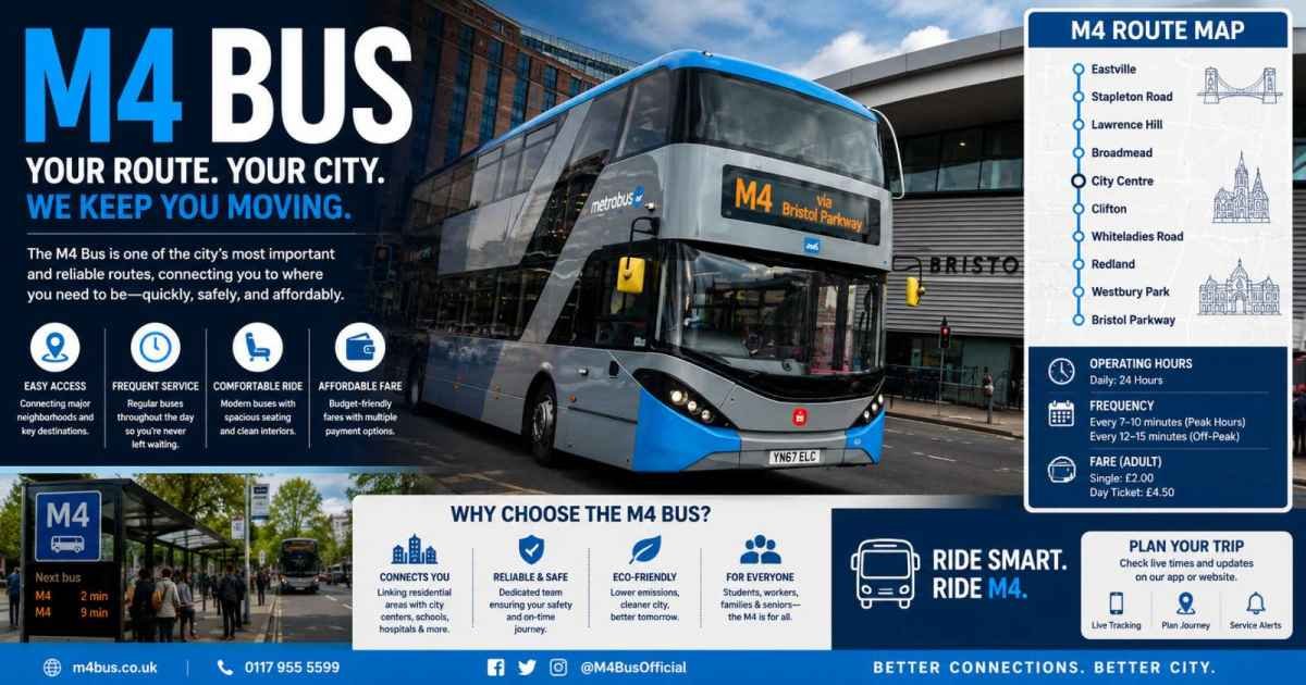
Table of Contents
ToggleThe M4 bus is one of the most important and busiest public transport services used by millions of passengers every year. Whether you are a daily commuter, student, office worker, or tourist, the M4 bus offers an affordable, reliable, and convenient way to travel. Depending on the city or country, the M4 bus serves different routes, but its goal remains the same—connecting people to major residential, commercial, educational, and tourist destinations.
In this complete 2026 guide, you’ll learn everything about the M4 bus route, schedule, major stops, ticket prices, payment methods, live tracking, and useful travel tips for making your journey easier.
What Is the M4 Bus?
The M4 bus is a major public transit route operated in several regions worldwide. The two most recognized services are the New York City MTA M4 bus and the Pakistan M4 Motorway bus services.
In New York City, the MTA M4 bus connects Midtown Manhattan with Washington Heights, traveling through some of Manhattan’s busiest neighborhoods. The route serves thousands of passengers every day and passes famous landmarks, universities, shopping districts, and cultural attractions.
In Pakistan, travelers often refer to buses operating along the M4 Motorway, which connects important cities such as Faisalabad, Gojra, Toba Tek Singh, Shorkot, Khanewal, and Multan. Multiple private transport companies use this motorway to provide comfortable intercity travel.
Regardless of location, the M4 bus helps:
- Reduce road congestion
- Provide affordable transportation
- Connect residential and commercial areas
- Offer reliable alternatives where metro or subway systems are unavailable
- Support environmentally friendly public transport
As cities continue investing in smarter transportation systems, the M4 bus has become an essential part of modern urban mobility in 2026.
M4 Bus Route and Major Stops in 2026
The exact M4 bus route varies depending on the city, but the New York City M4 remains the most searched route worldwide.
NYC MTA M4 Bus Route
The Manhattan M4 route begins at:
- East 32nd Street & 5th Avenue
- Travels north via Madison Avenue
- Passes through Midtown Manhattan
- Continues along Broadway
- Travels through the Upper West Side
- Serves Harlem
- Continues to Washington Heights
- Ends at The Cloisters Museum in Fort Tryon Park
Major M4 Bus Stops
Some of the busiest M4 bus stops include:
- East 32nd St & 5th Avenue
- Madison Avenue & 42nd Street (near Grand Central Terminal)
- Broadway & West 72nd Street
- Broadway & West 110th Street (near Columbia University)
- West 135th Street & Broadway
- Fort Washington Avenue & 177th Street
- Fort Tryon Park – The Cloisters
Depending on direction, the route serves approximately 70 to 80 bus stops, making it one of Manhattan’s longest north-south bus services.
M4 Limited (M4 LTD)
During weekdays, commuters can use the M4 Limited service.
Benefits include:
- Stops only at 44–45 major stations
- Faster journey
- Saves around 20–25 minutes
- Ideal for office workers and students
Pakistan M4 Motorway Bus Route
In Pakistan, buses using the M4 Motorway commonly connect:
- Faisalabad
- Pindi Bhattian
- Gojra
- Toba Tek Singh
- Shorkot
- Khanewal
- Multan
Popular transport operators include Faisal Movers, Daewoo Express, and Niazi Express, offering multiple daily departures.
M4 Bus Schedule, Timings and Frequency
The M4 bus schedule is designed to provide reliable transportation throughout the week.
Weekday Schedule
- First bus: 5:22 AM
- Last bus: 12:30 AM
- Peak-hour frequency: Every 8–15 minutes
Weekend Schedule
- First bus: 5:55 AM
- Last bus: 11:45 PM
- Frequency: Every 12–20 minutes
Limited Service
The M4 LTD operates only on weekdays and serves major stops for faster travel.
Although buses follow fixed schedules, arrival times can change because of:
- Heavy traffic
- Road construction
- Weather conditions
- Public holidays
- Special city events
Checking live arrival information before leaving home is always recommended.
M4 Bus Fare, Ticket Prices and Payment Options
One of the biggest reasons for the M4 bus‘s popularity is its low ticket price.
New York City Fare
The standard MTA M4 bus fare in 2026 is:
- $2.90 per ride
Passengers can pay using:
- OMNY contactless payment
- MetroCard
- Exact change (coins)
A major advantage is the free transfer between buses and subways within 2 hours when using OMNY or MetroCard.
Pakistan M4 Motorway Bus Fare
Depending on distance and operator, fares generally range from:
- PKR 500
- Up to PKR 1,500
Many operators also provide:
- Online booking
- Mobile ticketing
- Luxury seating options
- Family discounts
- Student promotions during selected periods
Senior citizens and passengers with disabilities may also qualify for discounted fares where applicable.
Key Features and Facilities on M4 Buses
Modern M4 buses in 2026 provide far more comfort than older public buses.
Passengers can enjoy:
Climate-Controlled Interiors
Air conditioning in summer and heating during winter create a comfortable journey.
Free Wi-Fi
Many buses now offer onboard Wi-Fi, allowing passengers to browse the internet, work remotely, or stay connected during travel.
USB Charging Ports
Charging ports are available on many newer buses, helping passengers keep phones and tablets powered.
GPS Live Tracking
Every bus is equipped with GPS technology that provides accurate arrival times.
CCTV Security
Security cameras improve passenger safety and help monitor onboard activity.
Wheelchair Accessibility
Low-floor entrances and wheelchair ramps make boarding easier for elderly passengers and individuals with disabilities.
Comfortable Seating
New buses feature:
- Spacious seating
- Better suspension
- Larger standing areas
- Additional luggage space
Eco-Friendly Hybrid Technology
Many transit agencies now operate hybrid or low-emission buses, reducing pollution while improving fuel efficiency.
How to Track the M4 Bus Live in 2026
Finding your bus has never been easier.
Passengers can monitor the M4 bus live location using several tools.
Moovit App
Search for the M4 route to view:
- Real-time bus location
- Estimated arrival time
- Nearby bus stops
- Route planning
MTA Bus Time App
New York passengers can track every M4 bus using the official transit application.
Google Maps
Simply search:
- M4 bus near me
- Nearest M4 bus stop
- M4 bus arrival time
Google Maps displays live bus locations, route changes, and walking directions.
Official Transit Websites
Most transport authorities publish:
- Interactive route maps
- Timetables
- Service alerts
- Delay notifications
SMS Services
Some cities allow passengers to send a bus stop code via SMS to receive the next scheduled arrival time.
Using live tracking significantly reduces waiting time and helps passengers better plan their journeys.
Travel Tips and Why the M4 Bus Is the Best Choice in 2026
Following a few simple travel tips can make every trip smoother.
- Travel during off-peak hours (avoid 8–10 AM and 5–7 PM) for less crowded buses.
- Use OMNY or contactless payment instead of cash for quicker boarding and free transfers.
- Choose the M4 Limited (M4 LTD) whenever your destination is one of its major stops to save valuable travel time.
- Keep personal belongings secure, especially in busy areas such as Midtown Manhattan and Harlem.
- Tourists should ride to The Cloisters, located in scenic Fort Tryon Park, for one of New York City’s most peaceful museum experiences.
- Check live updates before traveling during severe weather or major city events.
With rising fuel costs, increased traffic congestion, and growing environmental awareness, public transportation continues to be the smartest travel option.
The M4 bus stands out because it offers:
- Affordable fares
- Frequent service
- Reliable schedules
- Modern onboard facilities
- Eco-friendly vehicles
- Excellent accessibility
- Convenient connections to major neighborhoods, business districts, schools, and attractions
Final Verdict
The M4 bus remains one of the best public transportation options in 2026, whether you’re riding the New York City MTA M4 through Manhattan or traveling along the Pakistan M4 Motorway between major cities. Its combination of affordable fares, extensive routes, modern amenities, live GPS tracking, and frequent service makes it an excellent choice for commuters and visitors alike.
Before starting your journey, check the latest schedule using a live tracking app, choose the most suitable route, and take advantage of contactless payment options for a faster, smoother travel experience. Whether you’re commuting to work, heading to class, or exploring a new destination, the M4 bus continues to provide a safe, efficient, budget-friendly, and dependable way to travel in 2026.

Millie Bobby Brown: Career, Movies, Stranger Things, and Enola Holmes

2005 Chevy Avalanche: Specs, Engines, Towing Capacity, Features and Buying Guide

Yo Soy El Que Manda: Meaning, Origin, and Why the Phrase Became So Popular

The Ultimate Guide to Creating a Quantity Button HTML: Boosting E-commerce UX and Conversion Rates

The Ultimate Guide to Radio Z 92.3 Miami: Miami’s Premier Destination for Salsa and Tropical Music

Lauren Dascalo: The Rise of a Fitness Icon and the Power of Body Positivity
Trending
 Business4 months ago
The Ultimate Guide to Creating a Quantity Button HTML: Boosting E-commerce UX and Conversion Rates
- Entertainment4 months ago
The Ultimate Guide to Radio Z 92.3 Miami: Miami’s Premier Destination for Salsa and Tropical Music
- Fitness4 months ago
Lauren Dascalo: The Rise of a Fitness Icon and the Power of Body Positivity
- lifestyle4 months ago
Mark Fluent: Biography, Career, Net Worth, Family, and Life Beyond the Spotlight
- Fashion4 months ago
Grape Shoes: A Complete Guide to Purple Sneakers and Sustainable Grape Leather Footwear
- Animal3 months ago
The Ultimate Guide to SD Antelope: Hunting, Biology, and Conservation in South Dakota
- Fashion4 months ago
Dressel Designs YoYo: Innovation, Premium Craftsmanship, and Why Collectors Love the Brand
- Sports4 months ago
Cricfooty: The Complete Guide to the Emerging Cricket-Football Phenomenon in 2026